
By Dr Melanie Roberts
Read Time: 1000 words about 6 mins.
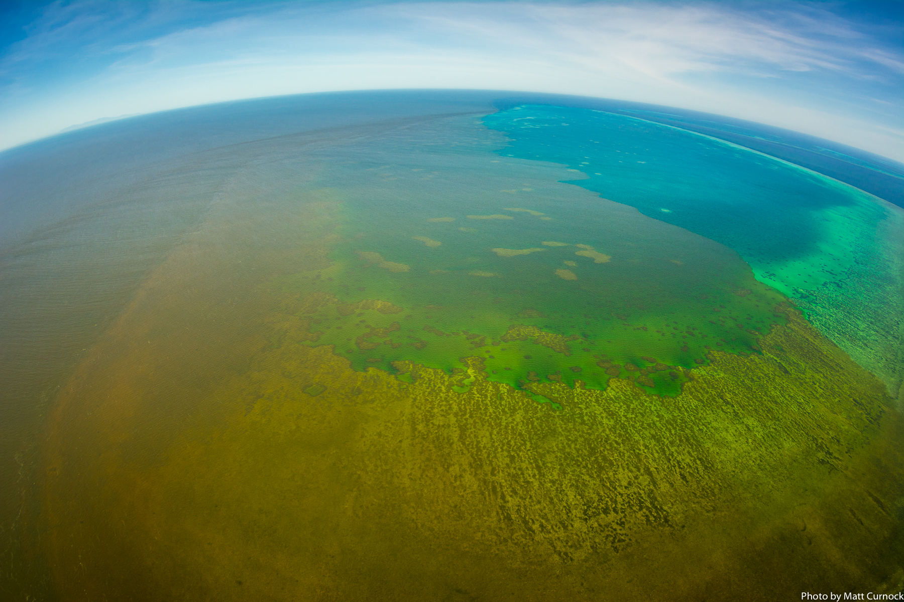
Climate change and poor water quality are placing unprecedented pressures on the reef, and it is imperative that these stressors are eased to provide the reef with an opportunity to recover.
Australia is home to the largest living organism in the world, the World Heritage Listed Great Barrier Reef (GBR). The GBR is home to three-quarters of the world’s coral species, six of the world’s seven species of marine turtle, more than 1500 species of fish, and iconic animals such as dugongs, whales, sharks and rays. A healthy marine environment is essential for the species reliant on the GBR. However, the GBR is under threat from the pressures of human activity. Without measures to reduce damage to the fragile ecosystem we could see the destruction of one of the natural wonders of the world within decades.
The Queensland Government and the Australian Government aim to reduce anthropogenic end-of-catchment sediment and particulate nutrient loads by 25% and dissolved inorganic nitrogen loads by 60% by 2025.
As poor water quality negatively effects the reef, improving water quality is a key priority for reef preservation. Sediments and nutrients transported from the catchment to the GBR lagoon affect the reef in many different ways. High nutrient levels are linked to crown-of-thorns starfish and algal bloom outbreaks, while sediment reduces light availability, affecting seagrass growth, and can even bury corals, leading to tissue necrosis and coral death. The Queensland Government and the Australian Government aim to reduce anthropogenic end-of-catchment sediment and particulate nutrient loads by 25% and dissolved inorganic nitrogen loads by 60% by 2025. Best management land use practices are the key factor in achieving these objectives. The goal is for best management practices to be in use for at least 90% of selected land in priority areas.
High nutrient levels are linked to crown-of-thorns starfish and algal bloom outbreaks, while sediment reduces light availability, affecting seagrass growth, and can even bury corals, leading to tissue necrosis and coral death.
Up to 40% of accelerated sediment transported to the GBR originates in gullies, [1]. Reducing erosion due to gullies provides an opportunity to make significant inroads on the water quality improvement targets for the reef. As sediment also contributes to the particulate and dissolved inorganic nitrogen and phosphorus loads by acting as a transport vehicle, reducing gully erosion decreases both sediment and nutrient loads in the GBR.
Implementing best management practice systems in grazing lands is expected to reduce gully erosion by 25%, [2]. It is known that practices such as managing stocking rates reduces erosion by reducing land disturbance, allowing ground cover to increase and mature trees to establish. However, the timeframe for these practices to translate into observed reductions in sediment load is not well understood.
Given that the reef is already showing negative effects from multiple stressors, it is important to understand whether the current pace of action is sufficient to protect the reef in the short-term.
While there is confidence that implementing these practices will improve water quality on the reef in time, there is little evidence to indicate the short-term benefits of enhanced land management. Given that the reef is already showing negative effects from multiple stressors, it is important to understand whether the current pace of action is sufficient to protect the reef in the short-term.

In collaboration with Rob Ellis (Queensland Government Department of Environment and Science) we completed a modelling exercise investigating the potential impact on end-of-system sediment loads due to gully erosion in an example catchment. The modelling exercise delayed the benefits of improved land use management practices investigating potential impacts.
Using the modelling framework for the GBR Report Cards, which supports the evaluation of progress made towards water quality targets, we delayed the benefits of improved land use management practices at a number of theoretical rates. This allowed us to assess differences to the end-of-system delivery of sediment.
Our case study is the Bowen River catchment, located within the greater Burdekin catchment. The Burdekin catchment drains into the GBR south of Townsville. The catchment is dominated by grazing and is an identified hotspot for gully erosion. An estimated 94.7% of sediment reaching the headwaters of the Bowen catchment will be discharged into the GBR lagoon.
Our modelling study was undertaken using the eWater Source platform, using an implementation developed to support the GBR Report Cards and related studies. To explore the effect of delayed benefits to improved land use management practices we modified the “management factor” term in the Dynamic SedNet model for Gully Erosion for 24 different scenarios.
Our results showed that the rate at which the benefits of improved land use management practices are realised can be significant.
Our results showed that the rate at which the benefits of improved land use management practices are realised can be significant. For example, assuming the benefits of improved practices are immediately apparent, across the full 28-year simulation a reduction of gully erosion of 12.4% would be achieved if 90% of the Bowen River catchment was managed according to best management practices. However, delaying benefits for 5 years results in only a 7.5% reduction. In comparison, 60% of land managed under best practice reduces gully erosion by 8.3%, assuming immediate full benefit. Therefore, delaying benefits from improved land management practices could be equivalent to missing the target for land managed under best practice by a third.

The interaction between the rainfall-runoff and the benefit received has the largest impact on the end-of-system delivery of sediment. Gully erosion is driven by runoff, and therefore periods with higher rainfall will have higher erosion than periods with low rainfall. Therefore, the impact of reducing erosion on the total sediment load reaching the GBR is greater during high rainfall events. Our preliminary study considered just one climate scenario, and therefore a different climate signature would likely see different specific results.
We need to know more about how long it takes for improved land use management to result in reduced erosion from gullies. As this research has shown, understanding how long it takes for erosion to be reduced is important to accurately predict short-term outcomes. Further work is required to understand how gully erosion responds to interventions and what the benefits look like over time. This will enable us to better predict the outcomes of sediment load reductions from investment programs.
You can follow Dr Melanie Roberts on Twitter at @melanieemmajade and read more about this research from
Roberts, M. E., & Ellis, R. (2019). Effects of Temporal Variation in Sediment Reduction Following Improved Land Management Practices on End-of-System Delivery: a Modelling Investigation of a Grazed Catchment in Queensland, Australia. In WIT Transactions on Ecology and the Environment (Vol. 234, pp. 9–20). Southampton UK: WIT Press. http://doi.org/10.2495/RBM190021
Project Partners:
- Melanie Roberts thanks the Queensland Government for their support through the Queensland Water Modelling Network (QWMN) Fellowship. The QWMN aims to improve the state’s capacity to model its surface water and groundwater resources and quality.
Photo Credit:
Matt Curnock. Support for the aerial footage was provided by TropWATER JCU, the Marine Monitoring Program – Inshore Water Quality through the Great Barrier Reef Marine Park Authority, the Queensland Government, the Landholders Driving Change project led by NQ Dry Tropics, CSIRO and the National Environmental Science Program Tropical Water Quality Hub.
References:
- Brooks, A. P., Spencer, J., Doriean, N., Pietsch, T. J., & Hacker, J. (2018). A comparison of methods for measuring water quality improvements from gully rehabilitation in Great Barrier Reef catchments. (pp. 1–8). Presented at the Proceedings of the 9th Australian Stream Management Conference, Hobart, Australia. https://www.researchgate.net/publication/335989248_A_comparison_of_methods_for_measuring_water_quality_improvements_from_gully_rehabilitation_in_Great_Barrier_Reef_catchments
- Reef 2050 Water Quality Improvement Plan 2017 – 2022 (2018). https://www.reefplan.qld.gov.au/
