Author: Dr Vanessa Reis,
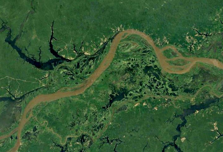
Wetland ecosystems are important hotspots of biodiversity in the Amazon River Basin, but they’re under threat from human activity. These ecosystems rely on the maintenance of the annual river flood pulse that drives inundation across the major wetlands of the Amazon.

Infrastructure project proposals such as dams have increased in response to higher demands for energy, and the expansion of agricultural frontiers has placed pressure on the long term survival of wetland ecosystems. If wetlands disappear the environmental services that these systems provide will disappear too, threatening the very future of the Amazon River.
Catchment integrated planning can aid the proposition of freshwater zoning, which helps to preserve essential dimensions of water connectivity between rivers, wetlands, and lakes. In our study recently published in the journal Aquatic conservation: marine and freshwater ecosystems, we present a new approach able to represent wetland spatiotemporal inundation in a map format that can be used for conservation planning and management.

This new approach may provide new perspectives for conservation and management of wetlands because the temporal connectivity can also be accounted for, and this is an important aspect especially in regards to minimising the effects of dams, that can directly impact the natural wetland dynamics.
Using remote sensed inundation maps and a statistical classification technic, we presented a consistent method to integration inundation dynamics into wetland classification, this captures regional differences in timing and duration of inundation in wetlands. Also, exploring the precipitation regime in major wetland complexes we could tell the story of regional water dynamics driven by pluvial influence and/or flowing from permanent rivers to seasonal wetlands.

This new approach may provide new perspectives for conservation and management of wetlands because the temporal connectivity can also be accounted for, and this is an important aspect especially in regards to minimising the effects of dams that can directly impact the natural wetland dynamics.
The use of global remotely sensed inundation data makes this approach easily transferable to other large tropical wetlands.
Access the full paper here: https://onlinelibrary.wiley.com/doi/full/10.1002/aqc.3051